Visual navigation of an urban drone without GNSS
R&D Internship · Astek Research Network · Toulouse, France
In dense urban environments, GNSS (GPS) signals suffer significant degradation due to the urban canyon effect and multipath, making classic geolocation unreliable. This research project aims to evaluate the performance of a multi-lateral-camera perception device embedded on a micro-drone, using building facades as visual references to geolocate without relying on GPS. I conducted the state of the art, formalized the scientific challenges, developed the analytical modeling of two position estimation approaches, then designed a Python numerical simulator with a Monte-Carlo sensitivity analysis. Experimental validation is carried out on real images and video streams of urban scenes.
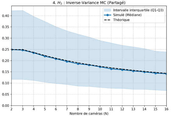
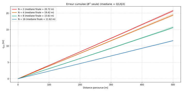
Simulation Results The Monte-Carlo analysis validated the model's consistency with theory: the gap between simulated results and the theoretical behavior remains < 5% over the entire studied range. The parametric study highlights the model's sensitivity to its various parameters, enabling a significant reduction of position estimation error under operational conditions.
- Python
- NumPy
- SciPy
- OpenCV
- Matplotlib
- Monte-Carlo
- Geometric modeling
Technical details subject to confidentiality (C2 · Controlled Distribution).